Using Technology to Improve Land Oversight
How Mapping Tools, GPS Data, and Visual Records Support Professional Land Management
Land management still starts the same way: getting out in the field and understanding how each property is laid out and used. What has changed is how we capture, organize, and share what we see. Technology supports that work by improving documentation, consistency, and communication with landowners. At Pifer’s Land Management, we use mapping tools, GPS data, and photos to keep records clear and organized so landowners can easily understand what’s happening on their property.
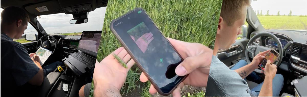
We use mapping and GPS tools like OnX and AgriData to reference boundaries, estimate acreage, and identify access points. While these tools don’t replace a legal survey, they provide a dependable field reference when managing many properties across a wide area. They also help ensure our notes, photos, and observations are a true representation of the land and stewardship practices. For landowners, that means reporting that’s easier to follow and easier to trust, because it’s backed by clear, documented information.
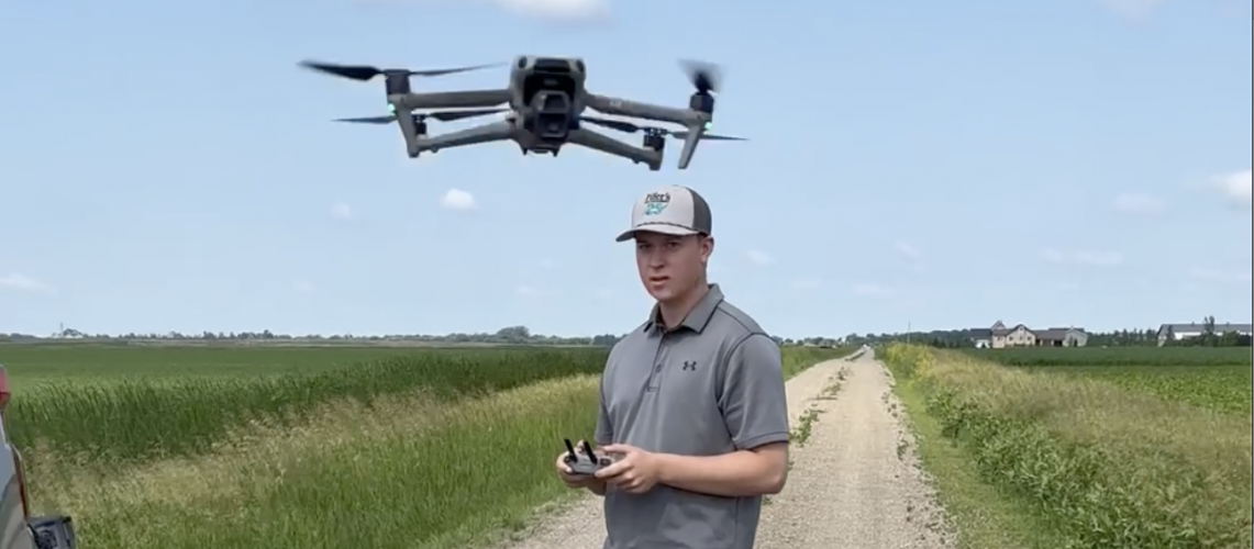
Photos are a regular part of our field work. During a visit, we take dated images to document conditions, access points, and any issues that may need attention. Ground-level photos support our written notes and give landowners a clear snapshot of what the property looked like at that time. In some situations, we also use drones to capture an overhead view, which can highlight patterns or problem areas that aren’t obvious from the ground. Combined with on-site observations, these visuals add helpful context and improve decision-making.
Technology also helps us maintain precise records over time. Each landowner has a dedicated file with subfolders for individual properties, inspections, photos, and other key documents. Organized records make it easier to review past conditions, track changes, and keep details straight across multiple years. That becomes especially important when questions come up later about land use, access, or insurance, because dated notes and photos help show what was happening at the time of inspection, and allow issues to be addressed more efficiently.
Technology doesn’t replace the work we do in the field; it strengthens it. We still spend time on each property, understanding its attributes and stewardship practices, along with working with the tenants to make sure these practices are carried out. These tools help us document observations accurately, stay organized, and communicate clearly with landowners. At Pifer’s Land Management, we combine practical technology with hands-on field work to protect land value over time and give landowners confidence that their property is being well cared for.
Author Bio: Gavin Hlubek is a Land Management Specialist with Pifer’s Land Management and brings a strong agricultural background to the team. Originally from Mahnomen, Minnesota, Gavin grew up on his family’s corn and soybean farm, where he developed a passion for agriculture and land stewardship. He earned his bachelor’s degree in Agribusiness from North Dakota State University after completing an associate’s degree in liberal arts and sciences. Gavin’s hands-on farming experience, leadership background, and knowledge of agriculture make him a valuable resource for landowners across the region.